
Several members of the Andrew Johnson ARC recently became interested in National Weather Service (NWS) weather balloon/sonde tracking and hunting.
If you don’t know what a weather sonde is, it is a meteorological instrument launched hanging from a helium or hydrogen balloon on a string. They are used to monitor atmospheric conditions such as temperature, humidity, barometric pressure, wind speed and direction at different altitudes as it rises. GPS is used to provide accurate position data and the altitude.
The balloons can rise to over 100,000 ft. Usually the balloon ascends around 800 to 1200 feet per minute. The atmospheric pressure decreases as the balloon rises. Reduced atmospheric pressure causes the balloon to expand until it bursts. When the balloon bursts, the sonde (instrument package) falls back to the ground. If all goes well, a small parachute (usually orange in color) deploys to help slow it down as it descends. The sonde usually has to fall a long way before the air density is enough to inflate the parachute enough to slow the descent to around 1000 to 500 feet per minute. Sometimes the parachute can get tangled up with the strings or balloon remnants and its descent rate is greatly increased. The components of the sonde are small and light enough that if it did hit something it would not cause damage. Danger to air traffic is minimal.
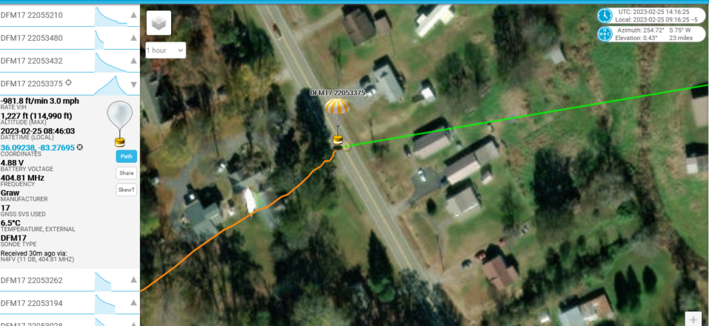
Telemetry is transmitted back to the NWS and used to help forecast weather and also is of use to air traffic. The transmitter in the sonde operates in the 400 to 406 mhz range in the US and is rated 100 milliwatts output or less. Each NWS facility seems to use one assigned frequency. The battery life is rated for greater than 4 hours by the manufacturer and it usually doesn’t last more than a few hours once it falls to the ground. The telemetry can be received up to a few hundred miles away on a FM receiver when the balloon is high in the air. Once a sonde has landed the range is not very far, perhaps only a few miles at the most. To find one on the ground requires either receiving the telemetry and decoding it to get the GPS coordinates or use traditional RF directional finding. If one has the GPS coordinates, then it can be easily found when the battery dies. RF direction finding only works as long as the battery is not dead and the sonde is still transmitting. Or you can try to get lucky and go looking near the last known coordinates. The orange parachutes (which most have) stand out really well or you might spot the white cord or latex balloon remnants.
www.sondehub.org is a website dedicated to tracking weather sondes all over the world with volunteers uploading tracking data on each sonde they receive and its updated in near real time. The weather balloons are released world wide twice a day at and 1100 and 2300 UTC. Or 6 am and 6 pm EST. Don’t forget DST changes that to 7 am and 7 pm EST. The closer to the ground a sonde is tracked, the chances of recovering it are greatly increased as the search area is reduced.
There are 2 North America Facebook groups at this time that are involved in the tracking and retrieval of weather sondes or weather balloons. https://www.facebook.com/groups/444260440607754/ is Radiosonde North America / NWS Weather Balloon is a private group that has a lot of active members that are involved with sonde tracking and hunting. Ranse (the group administator) is a very knowledgable when it comes to all aspects of tracking and finding them. They are mostly based in the midwest and west coast. The members are an excellent source of information for almost anything relating to sondes. The other group is new and called Sonde Hunters and Trackers https://www.facebook.com/groups/1190157138602373 that is currently focused on NWS balloon launches from Nashville Tennessee as of Feb 1. This group has potential to grow.
Chris Remboldt is now publishing a FREE monthly online magazine that is available from https://www.sondehunter.com/. The issues contain lots of pictures and information about recoveries, tracking, and other information.
All that you need to receive the sondes is a receiver connected to a decoder for the telemetry and a UHF antenna or one of the LORA PAX 32 TTGO boards flashed with appropriate firmware. I assembled a tracking receiver/decoder using a Raspberry Pi 3B and an RTL-SDR I had on hand. The Pi was loaded with the current version of Raspibian Bullseye 11 and then a software package called auto_rx was downloaded and installed. The Auto_rx download link and instructions are available from the www.sondehub.org.
My Radiosonde Tracking Station
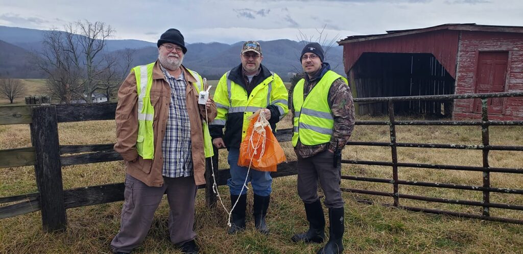
With the help of my son Chris N4CAG, we got it going and were able to start tracking sondes. The receiver and Pi were taken to AA4BS’s house as he is in a better location than mine and we started tracking sondes. We experienced some issues with the RTL-SDR I had, as it was noisy on the RX and also off frequency. But we did track a sonde that landed about 10 miles away and the coordinates we got from the last decode pinpointed its location to within about 500 ft above the ground.
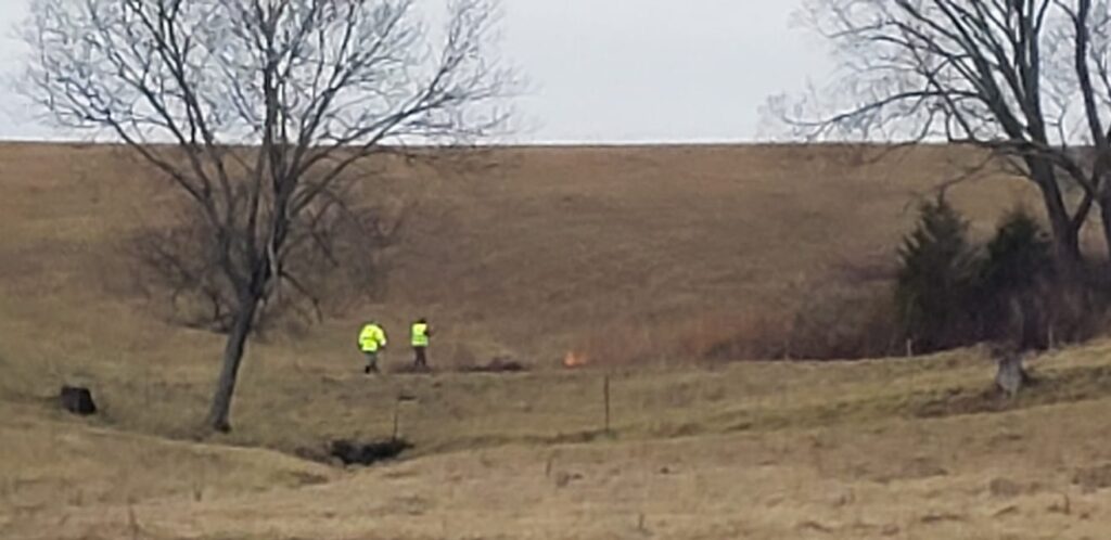
It was around 10 pm at night when we arrived at the site but were unable to locate it in the dark. It was not attractive to be tramping around in a farmer’s field in the dark and risk getting shot at. We knew we were close as we could receive the telemetry on an ht with the antenna taken off at times. So we returned the next morning and the orange parachute was spotted about a thousand feet away next to a pond. Permission was obtained to enter the property and remove it. The location was about 120 feet north of the last known GPS position. The night before we had gotten to within about 700 feet of it in the dark.